Author: DCWF
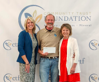
DCWF Receives Grant from the Community Trust Foundation
The Deep Creek Watershed Foundation received a grant from the Community Trust Foundation to help fund a free rain barrel distribution event in Garrett County. Through the generosity of community donors to the Foundation there are going to be one hundred free 50-gallon rain barrels given to participants. The only stipulation is that you attend a free class through University of Maryland Extension to learn more about maintaining and using the barrel. Classes are planned for late June.
A rain barrel is a container that is used to capture rainwater to help mitigate stormwater. The water can then be used for non-potable tasks such as washing vehicles or watering ornamental gardens/lawns. The goal is to slow down the water and let it soak into the ground after the rain event. If you are interested in earning a free rain barrel, please contact Ashley (email abachtel@umd.edu or call 301-334-6960) with University of Maryland Extension.
For more information on the benefits and approach for rain barrels, please click here to access our Rain Barrel Fact Sheet.
Newly Appointed Secretary of DNR Visits Deep Creek Lake
DEEP CREEK LAKE — Newly appointed Secretary of the Department of Natural Resources (DNR), Josh Kurtz, visited Deep Creek Lake on July 26.
This visit included a boat tour of the lake and a buffet at Ace’s Run hosted jointly by the Deep Creek Lake Property Owners Association (POA) and the Deep Creek Watershed Foundation (DCWF).
The agenda of the visit included discussions of projects, plans, and current needs in the area. The success and benefits of past projects, the importance of the wellbeing of the lake and the importance of the relationship between the POA, DCWF, and the DNR were also discussed.
In attendance were State Senator Mike McKay, Garrett County Commissioners Paul Edwards, Ryan Savage, and Larry Tichnell, POA President Bob Sutton, DCWF President Bob Hoffmann, as well as lake and park managers and other POA and DCWF members.
Some of the topics discussed at lunch included the need for more manpower for lake management, park management, and NRP, future funding for the lake, and the successful relationship between DCWF, POA, and the DNR.
“It was a wonderful trip”, says Secretary Kurtz, “I think one thing that stood out to me was how well everybody in this room works together, and I think that’s a testament to the success you see on the lake, and the opportunities for us to continue to do more…I mean the number of people that are investing their money to make the lake better really stood out.”
Senator Mike McKay compared the relationship between the organizations to a three-legged stool.
“As much as we appreciate all the beauty here, it has to be properly managed…if one leg is longer than the others, we’ll fall off the stool so it’s a proper balance,” said McKay.
DCL POA President Bob Sutton said, “We all appreciated Mr. Kurtz taking a day to visit the lake and are looking forward to working with him and his staff in the future!”
Deep Creek Watershed Foundation Recipient of Garrett County of the 2021 William Donald Schaefer Helping People Award
On Saturday morning, October 1, 2022, The Deep Creek Watershed Foundation (DCWF) will be honored as the recipient for Garrett County of the 2021 William Donald Schaefer Helping People Award. This award will be presented to the DCWF by the State of Maryland’s Comptroller, Peter Franchot. More information about this annual award and program can be found at the link below:
https://www.marylandtaxes.gov/divisions/comp/peter-franchot.php#wds
The DCWF is a 501 (c) 3 non-profit organization formed in 2016 and designed to accept tax deductible donations and use those donations over time to support the implementation of the Deep Creek Watershed Management Plan (WMP). The WMP was created in a collaborative effort between citizens of Garrett County, Garrett County Government, and the Maryland State Department of Natural Resources. It was clear to some of those citizens who assisted in the development of the plan, that neither the State nor County would alone be able to fund the myriad of projects necessary to implement the plan. To address this fiscal reality, the DCWF uses a methodology of creating public/private partnerships to fund projects DCWF and the projects if has supported thus far as well as planned for the future can be found on our Projects Page
The DCWF has an all-volunteer Board of Directors as well as a very supportive group of Advisors and Volunteers who assist the board in a wide variety of ways.
Financial support is received from individual donors, event sponsors, and grants, nearly, all of which, is applied to projects. Individuals wishing to donate may go donate via PayPal or forward checks to:
The Deep Creek Watershed Foundation
P.O. Box 376 Oakland, Maryland 21550
Arrowhead Stream Biological and Water Quality Survey
PROJECT NARRATIVE
Arrowhead Cove in the site of a pilot dredging project in Deep Creek Lake. The Deep Creek Watershed Foundation is using this opportunity to conduct a biological and water quality survey of Arrowhead Run, a tributary to Deep Creek Lake.
The area of interest encompasses an approximately 0.4 mi. reach extending from a natural wetland at the upstream boundary to its confluence with Deep Creek Lake. Two in-stream 100-m sampling stations will be designated and georeferenced – (1) below outflow of wetland; and – (2) above confluence with Deep Creek Lake where stream channel is well-defined. At each site a water sample will be collected, fish community composition will be determined by electrofishing, and macroinvertebrate community sampled by kick or sweep netting. An in-stream habitat evaluation score will be determined at each sampling site. In addition, water samples will be collected above and below the wetland to determine its effect on downstream water quality, particularly nutrient and suspended solids loadings. A project summary will be prepared based on analyses described above that can serve as a baseline for future biomonitoring and bioassessment.
Water quality. On-site measurements of temperature (C), pH, specific conductance uS/cm2 will be taken at the time of biological sampling at Stations 1 and 2. A sample will be taken for analysis of total alkalinity (mg/l as CaCO3) in the laboratory at California University. Samples will also be collected above and below the wetland and transported to a certified laboratory (H&H Water Controls, Carmichaels, PA) for analyses of nitrates, phosphates, and total suspended solids (TSS).
Habitat. In-stream habitat quality will be scored and presented for Stations 1 and 2 employing the US EPA’s Rapid Bioassessment methodology (Barbour et al. 1999).
Fish. The fish community at each Station will be sampled over each 100 m reach by back-pack electrofishing. All collected individuals will be identified to species, enumerated, and released.
Macroinvertebrates. Macroinvertebrate sampling will be conducted at each Station by kick or sweep-netting according to substrate characteristics (Barbour et al. 1999). All organisms will be preserved in 70% isopropyl alcohol and transported to California University for processing. Organisms collected will be identified to the lowest practicable taxonomic level and enumerated.
Assessment Summary. The status of resident fish and macroinvertebrate communities are recognized indicators of stream health. Data from water quality and biotic analyses will be integrated into a comprehensive report on the condition of Arrowhead Run and provide a baseline for future biomonitoring and assessment.
The Foundation is negotiating with the University to have conduct this research to establish a base line for the stream. It is the Foundations wish to extend this work into all of the tributaries in the Deep Creek Watershed.
The Foundation will be pleased to accept donations for this effort. Go to the Donations page to do so.
Update: The Water Level Projects
Report to Donors to the Deep Creek Watershed Foundation:
The Water Level Projects
By David Myerberg
(This document is a deep dive into the problem, the role and success of the Foundation in its most expensive project to date.)
Background
Deep Creek Lake property owners, renters and others need an adequate depth of water in the lake for recreational purposes. Every year, in the fall through the winter, the Deep Creek Dam operator releases water to prevent ice from damaging the dam and eroding the shoreline. In the spring, the dam releases less water and natural runoff causes the water to rise to the limit of 2461 feet above sea level. The spring/summer recreational season runs from April to October.
The dam operator follows a permit, issued by Maryland Department of the Environment (MDE) which specifies releases for hydroelectric generation, temperature enhancement for fish health in the Youghiogheny (at the warmest time of the year), white water boating opportunities in the Youghiogheny, and maintenance of minimum flows. The permit also defines an operating range for the lake’s water level, called the upper and lower rule bands. (See table, below.)
Defining the Problem: Competing interests
Some stakeholders are interested in releasing water from the dam and, of course, others are interested in keeping water in the lake to assure adequate depth for recreational boating.
The Dam Permit which governs water releases attempts to balance these competing interests. The permit is renewed every 12 years, but challenges to the permit can be submitted and addressed in the intervening years.
In 2010, lake residents experienced serious problems due to low seasonal precipitation and the fact that, during that season, the dam operator ran the lake levels near the lower rule band. This resulted in the water dropping below the lower rule band and led to both significant loss of dock usage, (especially in the shallow coves) and limitation of releases for whitewater runs in the Youghiogheny.
When the water level gets as low as the lower rule band, roughly two-thirds of the whitewater releases are suspended, leaving only the weekend releases. This substantially cuts into the whitewater businesses and activities which are headquartered in Friendsville, MD.
Another related issue occurs when the lake is left at a very high levels. At this time, there can be substantial erosion of the shore line in various areas. Barriers on the waterfront to prevent this erosion are limited. Traditionally, the cost of such barriers accrue to homeowners, despite the fact that the land on which such barriers are built is owned by the State. Although there is some movement by Maryland Department of Natural Resources (DNR) and MDE to make permitting for walls and rip-rap somewhat less expensive, the cost to the average homeowner of doing this work is exorbitant. Furthermore, the effect of leaving the water level high through the season has not been studied in Deep Creek Lake.
Following 2011, the dam operator realized their mistake and kept the water levels near the upper rule band during the season. Erosion of the shoreline from boat wakes and weather induced waves was not studied prior to or during this time.
Role that the Foundation Played regarding Low Water Levels
Some changes were made to the dam Permit on June 1, 2011, based on the problems with dock access and limitation of whitewater releases during the prior year, but, by no means did these changes address the potential of future problems with water allocation.
By the time the Foundation formed in 2016, through their work on the Deep Creek Watershed Management Plan, many on the Board and Advisors knew that neither MDE, who issues the permit, the Dam operator, the outfitters in Friendsville nor DNR/fisheries were agreeable to substantial future changes in the permit.
By funding pointed scientific study, the Foundation sought to help resolve the conflict among the stakeholders who use the lake water in very different ways.
What did we do?
Through a generous donation, the Deep Creek Watershed Foundation spent nearly $100,000 to address the issue of low water levels on Deep Creek Lake.
In 2007 and 2008, the US Geological Survey (USGS) and MDE had performed measurements of the depth of Deep Creek Lake along its entire 70-mile shoreline. This is called bathymetry analysis. In 2017-18, the Foundation hired an engineering firm to calculate the actual number of docks disabled by lowering water to certain levels from this bathymetry data.
The Foundation hired the same engineering firm to develop a Water Budget Model (WBM).[1] This was a “proof of principle prototype” that showed that one could predict when the water was going to approach the lower rule band and could adversely affect both whitewater activities and access to lake docks. If the water level drops close to the lower rule band, this WBM could warn the Dam operator to diminish releases and prevent a further drop in levels.
How did the Foundation’s investment in the WBM and the Bathymetric Analysis change the dynamic?
First, the Foundation prepared its campaign to change the permit more than a year before it was due for renewal. Second, the Foundation presented the WBM and the Bathymetric analysis to local legislators and governmental officers. This was well received. Third, the Foundation traveled to Baltimore to present the WBM and the Bathymetric Analysis to MDE, DNR and the Dam operator, to emphasize that the dam permit not only could be changed to the advantage of those who used the Lake’s water on its surface, but for those who use the water in the Youghiogheny River.
Fourth, Senator George Edwards arranged a meeting between the Foundation, the dam operator, MDE, DNR and representatives of the Governor’s office so the Foundation could present its grievances and solutions regarding the dam permit. Fifth, the Foundation (and representatives of the Property Owners Association and their lobbyist) met in Baltimore with John Grace, the point person at MDE for the permit renewal to further define the position of lakefront owners.
The studies enabled by the major donation allowed the Foundation to present irrefutable scientific evidence that if water levels were too low, a specific number of lakefront property owners were adversely affected. Likewise, the WBM was mathematically proven to be a method that would keep this from happening under most future scenarios. The Foundation was able to involve and convince local and State elected officials of these facts and to show the dam operator and MDE that there was some political will in Annapolis in support of needed changes in the permit and the permit process. All parties were involved and on-board early and helped to assure that the permit process in 2019 was going to be transparent and broad-based.
The Result
The 2019-2020 permit process was very different and much better than earlier permit stakeholder assemblies. The present Dam operator, Brookfield Renewable Power, funded three lunch meetings moderated by MDE for the stakeholders at WISP, in which Brookfield, lake stakeholders, whitewater interests and fisheries presented information. The Watershed Foundation’s President presented summaries of the Bathymetric and Water Budget Model studies. Question sessions were thorough. These meetings occurred from February through the fall of 2019 and a Comment Period occurred. A Public Hearing occurred by Zoom in October, 2020.
Following the Public Hearing, MDE issued the permit and a 36-page response to all formal comments/questions. John Grace told the Foundation’s President that when he started in this permit process at MDE, around 2000, there was no background material for him to read and no one who was unbiased to consult. The detailed process in 2019 enabled him to give comprehensive answers to every question raised by stakeholders which he hopes will provide a more complete background for future permit renewals.
In the 2020 Permit, the dam operator is required to adopt and use a predictive model [similar to the WBM] to keep track of the lake water levels through the recreational season. Likewise, the dam operator is required by tight specification to maintain the water level as close as possible to the upper rule band throughout the season.
Despite the fact that the POA and the Foundation felt that there needs to be a permit requirement for predicting potential breaches of the lower rule band and for taking specific corrective action using some kind of modified protocol, MDE would not go that far. We assume that they believe this would only happen in the worst drought conditions, which may be true.
The Foundation’s Future regarding Water Levels in Deep Creek Lake
First, the Foundation has funded a project by the USGS which installed a lake level meter. The Foundation has committed to continued funding of this meter so stakeholders (including the Foundation) can follow this important variable and will have accurate data for future study.[2] This tool also has a recording water temperature component paid for by the Foundation. This will be valuable to fishermen and to biologists interested in the semi-annual temperature inversion which is the exchange of bottom water and surface water due to warming and cooling of the surface.
Second, lakefront owners are concerned about erosion caused by maintaining the water level at high elevation through the season. Erosion is already addressed as a problem in the Foundation’s guiding document, the Deep Creek Watershed Management Plan. The accurate measure of water level funded by the Foundation will add another dimension to studies of lake shore erosion and the Foundation hopes to support the necessary studies to help bring this under control.
Third, if a protocol is developed by stakeholders and MDE that defines actions for allocation of lake water in the case of severe drought, the Foundation will help with these deliberations.
Conclusion
This chapter in the Foundation’s history shows what we can do with tax-deductible donations, thoughtful application of science and working in a sensible way with government and other stakeholders to the advantage of the lake and watershed.
The concept and development of the Water Budget Model was done in large part by Morgan France, now Director of Projects for the Foundation. The implementation of the permit requirements, and indeed the management of the water levels, are based on knowing what the water level is. That is not a simple measurement of water levels based on the current geodetic datum. The elevation of the water levels in the lake assumes that the overflow weir at the dam is at elevation 2462 in the permit, and in subsequent records. 2462 was the elevation that was determined at the time the dam was built. The difference between the lake datum (2462) and the current geodetic datum is about minus 1.8 feet. The current lake level gauge maintained by Brookfield is based on the 2462 datum. The readings from that gauge are available on the internet. However, this gauge is a “single point of failure” for the management process. The annual report for the preceding year is filed with MDE and available usually in February of the following year. The new recording lake level gauge sponsored by the foundation has daily real time lake level data retrievable back to August of 2020.